


The Pacific Crest Trail (PCT) stretches about 2,650 miles along America’s West Coast, beginning a couple miles from the Mexican border and extending all the way into Canada. It traverses deserts and mountain ranges, crossing some of the most spectacular scenery in the entire country.
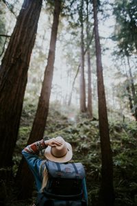
![]() It has attracted people of all stripes, and hiking most or all of the PCT has – for people like best-selling author Cheryl Strayed – served as a catalyst to changing one’s life. For many people, however, hiking the entire PCT in one continuous go isn’t feasible or practical. Some do it sections at a time over many years, while others tackle the smaller portions in their own backyards.
It has attracted people of all stripes, and hiking most or all of the PCT has – for people like best-selling author Cheryl Strayed – served as a catalyst to changing one’s life. For many people, however, hiking the entire PCT in one continuous go isn’t feasible or practical. Some do it sections at a time over many years, while others tackle the smaller portions in their own backyards.
For Skagit County residents of a certain demeanor and fitness level, a manageable portion of the PCT is accessible from our area, providing those who hike it with an amazing opportunity to take in our region’s natural beauty and solitude.
A Long and Winding Road
About 90 years ago, a businessman and former Boy Scout named Clinton C. Clarke envisioned a trail through California, Oregon and Washington that would feature amazing scenery and unspoiled wilderness. Clarke founded the Pacific Crest Trail System Conference in 1932, lobbying and planning for such a trail. Organizations like the Boy Scouts and YMCA supported the idea, as did a photographer named Ansel Adams.
Between 1935 and 1938, dozens of YMCA groups travelled in relays with logbooks and explored over 2,000 miles of land to decide a trail from the south to north borders of the west coast. The PCT took shape gradually, over several decades. In 1968, President Lyndon B. Johnson signed the National Trail Systems Act, naming the PCT and Appalachian Trail as the first official national scenic trails.
After this designation, the PCT Association, numerous land management and trail agencies, and many volunteers, constructed nearly 1,000 additional miles of trail. In 1993, the trail was declared officially complete.
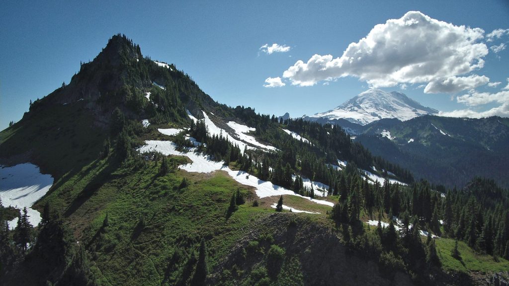
Among Washington’s section of the PCT, “Section K” is known as the most challenging. The 127-mile section extends from Stevens Pass in the south up to Rainy Pass in the North Cascades. Section K traverses through two federally-recognized wilderness areas, a national park, and contains 26,000 feet of total elevation gain.
Because of snow conditions that leave portions of trail too deep or dangerous to traverse for many months, the best time to hike is from late summer to early fall. Of that brutal 127-mile section, a few dozen miles pass Skagit County in northwestern Chelan County, taking hearty hikers into North Cascades National Park and the Stephen Mather Wilderness.
Getting There
It’s important note that nothing about this section of the PCT is what one would define as a leisurely day trip. A full day of hiking or a multi-day backpacking trip is more or less the norm here. From Skagit County, there are two ways to access the Pacific Crest Trail. Both involve trips along State Route 20, better known as the scenic North Cascades Highway.

The more unusual route involves departing Route 20 at Marblemount for Cascade River Road, which runs for 23 miles to the Cascade Pass Trailhead. Once on Cascade Pass Trail, it takes miles of trekking to actually reach the PCT, at which point the decision of whether to go north or south could be made. If making the turn north to Rainy Pass, one could be picked up and driven back to the Cascade Pass trailhead to complete a lengthy loop.
The most common access to the PCT comes with the eastward drive to Rainy Pass on the North Cascades Highway. There are several different ways to access the PCT from the Rainy Pass area, some using short connector trails. Remember that a Northwest Forest Pass is required regardless of where you’re hitting the trail. And a Backcountry Permit is required to camp overnight in North Cascades National Park.
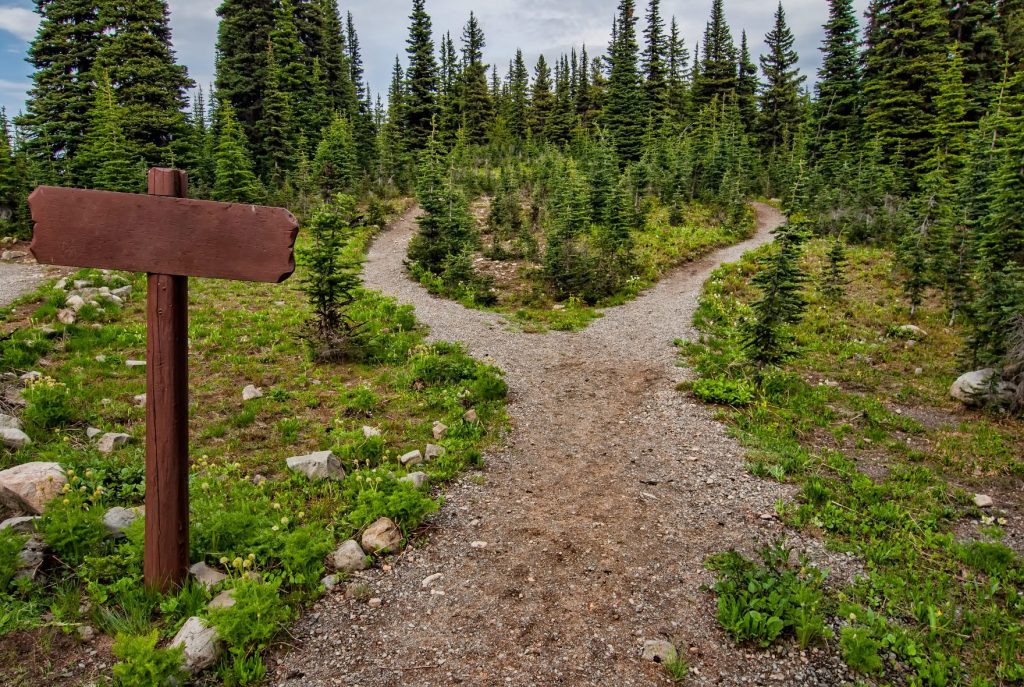
The path of the PCT itself heads south from Rainy Pass for about 2.5 miles, where it forks several different times to reveal numerous route options as it continues south. Regardless of what path you take (Twisp Pass, Bridge Creek or Cutthroat Pass, among other options), you’ll find primitive campground sites, stunning views, splendid foliage and chances to glimpse wildlife.
Eventually, the PCT runs into High Bridge Campground and Stehekin Valley Road. Be sure to follow proper trail and safety etiquette during whatever length of hike you choose, and as the saying goes, take only pictures and leave only footprints. Always check road and trail conditions before you leave.
For more information on other great Cascade hikes, visit the Washington Trails Association website.


