The Skagit River stretches for 150 miles from its mountainous beginning in British Columbia to its terminus into Skagit Bay. Its waters are important to the Native American tribes it is named after, to the local ecology of the region, and to hydroelectric power production. Like any river of notable size, it also has a history of flooding the low-lying lands around it. Here’s a look at several historic Skagit Valley floods.
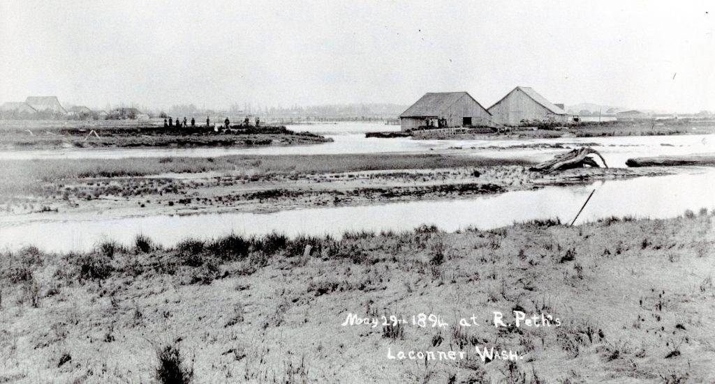
A flood in May 1894 created considerable property damage throughout the Skagit Valley, with estimates totaling half a million dollars (over $15 million today), according to an 1895 Skagit News article. This flood was one of the few times downtown Mount Vernon was completely flooded.
An Anacortes American article from the time reported Hamilton residents needing to navigate with boats, while water in parts of Sedro-Woolley was reportedly three feet deep.
1896
The year featured three floods. While the January and June events didn’t result in much damage, the flood of November 16, 1896 was different.
Rapidly rising river levels led to the hurried building of a dike atop an existing levee near Mount Vernon, preventing more than a foot of flood water from swamping the city. Other townships weren’t so lucky.
“The whole valley east of Sedro was a floating wilderness,” said one Skagit County Times article, noting that one Sedro-Woolley store was pulled from its foundation. In Hamilton, the entire town was inundated. One brick building collapsed, while several wooden structures were pulled from foundations. Several bridges were also destroyed.
Six hundred feet of Great Northern railroad track between Burlington and a river-crossing bridge was washed out. Homes and barns were heavily damaged in South Burlington. In West Mount Vernon, water rose one to two feet above the first floor of many buildings.
1897
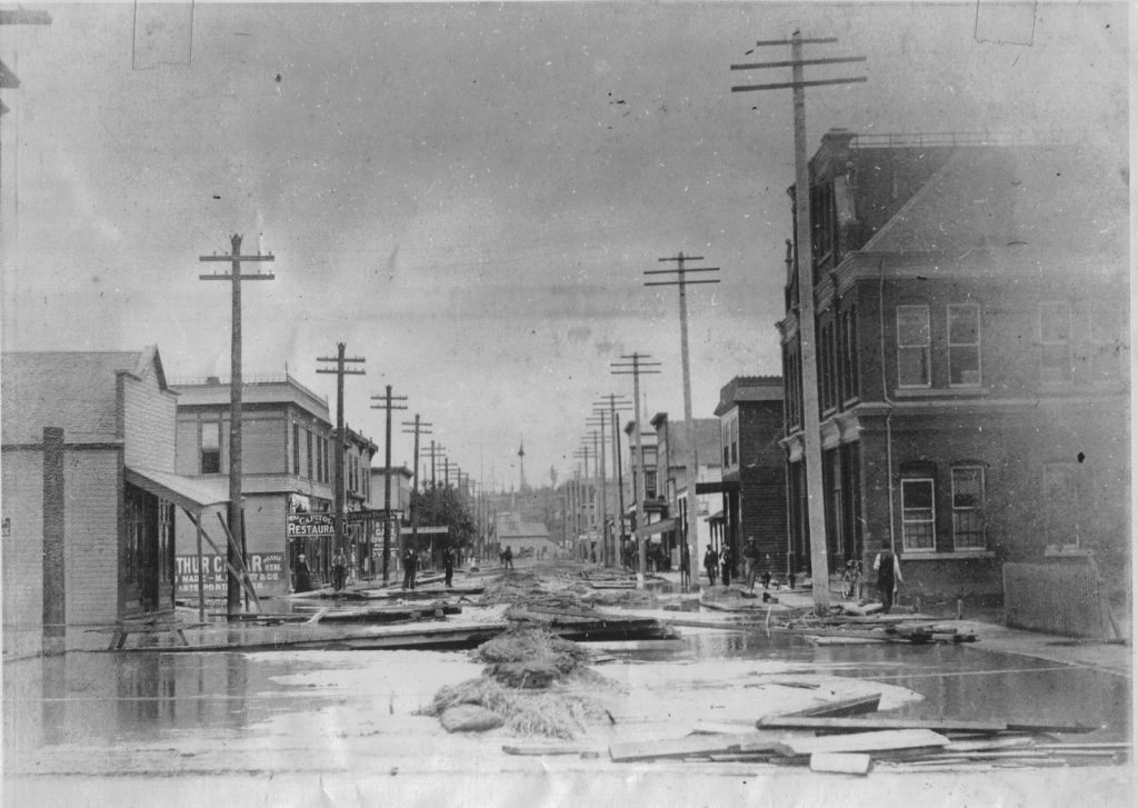
Almost exactly a year after the 1896 flood, levees along the Skagit were overwhelmed near Mount Vernon in 1897. In south Mount Vernon, the city’s lowest area, a levee break led to many homes being moved from their original locations.
One newspaper account details the plight of a Mr. Winkler, whose home was overtaken by water so quickly that he only had time to stand atop the door knob of an interior door while water rushed up to his chin. Once the door knob broke, Winkler swam to a window and broke out the top half of it to straddle the wood of the lower sash. He stayed there for hours with water to his waist before finally being rescued.
In another story, Cockreham Island’s Flynn family climbed through a crawl space into their attic to escape the water. One family member had been preparing pies on a table, and the family watched through the crawl space as pie shells floated away below them. The family remained stuck for three days until a Native American man put his canoe through the living room window and picked them up.
Mount Vernon’s Kincaid Street was washed out and became a large debris repository when the waters receded. The 1897 flood also mostly destroyed the original sites of Sauk City, Hamilton and Sedro.
1917
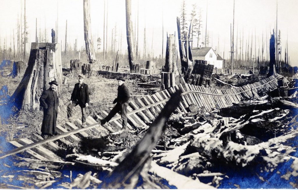
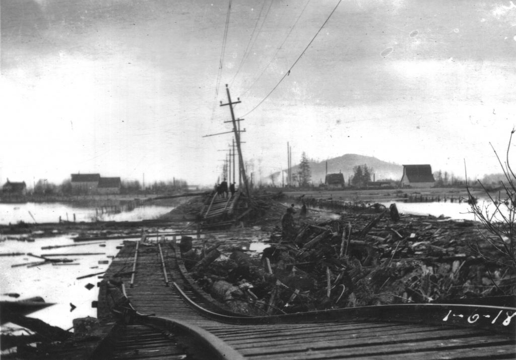
After heavy rain for several weeks, a large flood occurred five days after Christmas in 1917. In La Conner, a bridge was lost, but otherwise many buildings weren’t structurally damaged. Perhaps the greatest damage was to transportation, with miles and miles of Great Northern Railway tracks displaced. “In some places,” a newspaper clipping noted, road beds were “washed out to a depth of six and seven feet.”
The damage to the Interurban Railway tracks was extensive enough to knock out service between Mount Vernon and Bellingham for at least a month while it was repaired. In downtown Mount Vernon, what’s now Burlington Boulevard was littered with deep holes from where tree stumps were torn from the ground. At Stevens Slough, a home was tilted into a large hole.
In Clear Lake, flood waters submerged the mill and its electric dynamo, plunging the town into darkness. Sidewalks and fences were washed away. One man, Little John Gruber, died in the flood when he and his brother attempted to make their way through the floodwaters to their ranch.
Burlington, Edison and Edison reported street flooding, as did Sedro-Woolley. All told, dikes failed in at least eight places, and covered a large portion of the river delta.
1921
A December 1921 flood in Skagit County came on the heels of torrential rains and strong winds. The first flooding took place east and northeast of Burlington when several dikes failed. By the morning of December 13, everything north of the city was under water. This area reportedly had three to six feet of water, forcing residents there to the second stories of their homes.
The north fork of the river overwhelmed a dike near Conway, causing the towns of Conway and Stanwood to flood. The highway north and south of Mount Vernon was only passable by boat, and numerous reports between there and Burlington described homes moved from foundations.
An entire mile of the lower Sauk River was reportedly jammed with logs and other flood debris. Homes, barns, farmland and livestock were reported lost in many places. Hamilton was reportedly flooded by waters three to seven feet deep.
Overall, the 1921 flood was among the biggest in Skagit County history, at least in the oft-quoted memories of “old-timers” cited by local newspaper writers.
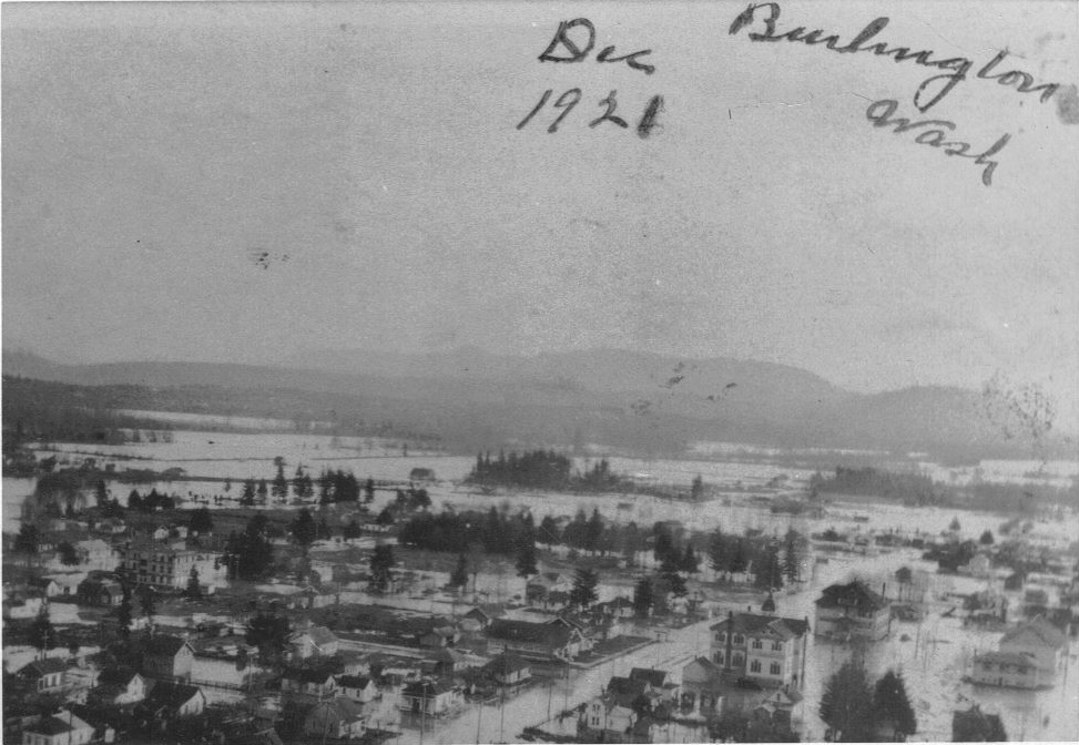
Photo courtesy: SkagitRiverHistory.com
For Further Reading
Throughout the 20th Century and into the 21st, the Skagit River has continued to flood. Although engineering has greatly improved residents’ protections whenever the river does rise, floods will continue being a natural hazard for many Skagit residents.
For a more in-depth look at the history and science of Skagit River flooding, check out Larry Kunzler’s website Skagit River History, from which much of this article’s information is derived.


