


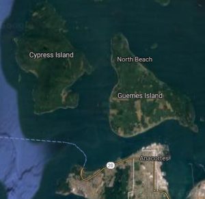
Two worlds separated by the waters of Guemes Channel.

Anacortes, 18,089 population (2020): 15.53 square miles fast foods, hospital, schools, and a gateway to the outside world and other islands with a bridge to Whidbey Island and large ferry terminal to Vancouver Island and other San Juans.
Guemes, approximately 600 full-time residents (2020 not available): about 8 square miles, many roads reduced to one-way traffic with repairs needed, a south beach with heavy impacts of erosion from waves, a mountain and forest lands preserved with great efforts, one fire station, one cemetery, one store, and lots of summer people.
Guemes Island is a five- to seven-minute ferry ride from the edge of Anacortes, Washington’s downtown at Sixth and I Avenue. The small ferry goes back and forth across the channel in a sharp contrast to the other ferries transporting people and cars from several miles away into the rest of the San Juan Islands. A schedule is online at the Guemes Island Ferry website.
Some visitors may walk onto the ferry. but that is if they have a vehicle on the other side or a friend picking them up. The island does not have a bus system and much of it is a bit far to simply walk.
Exploring Guemes Island

Driving off the small ferry you’ll see the only store, Guemes Island General Store. It’s best to stop.
A large solar-electric system, built to power the island’s only store, is evident behind it. Inside the offerings include succulent cakes and cookies, hearty food fare, and a wall of coolers for beverages and microwavable food selections.
Island maps, updated in 2021 and available upon request at the store for $1, are almost more picturesque than usable. But since the island is on the smaller side, it works. Mount Guemes, the highest point of the island at 688-foot elevation, described on a hiking webpage by one user as “easily done by an 80-year-old grandfather,” was a bit more difficult for a slightly-out-of-shape 50-something in the heat of the summer. A small parking strip was visible next to the road. Nearby signage and a post with hiking poles to be used by any in need were easily seen. Proceeding slowly up through the woods, soon there were breaks in the Douglas fir and Western red cedar trees to show the sky. The trail became steeper. One hiker, coming down the trail, commented to look for a bench, which would mean the top of the mountain was rather close at hand.
It proved to be a bit of comfort on the steeper portion of trail in the heat of the day when the bench was seen – and sat on.

An editor friend had made the same trek in the past year and said to enjoy the vista with views of mountains and islands. Hiking trails are outlined on the My Guemes website. Guemes Mountain Trail was collaboration between Washington Trails Association and Skagit Land Trust. The 2.4 mile, in and out, trail provides unexpected worthwhile views to almost every neighboring island: Samish Island, Cypress Island, Jack Island, Huckleberry Island, Dot Island and Hat Island.
Conservation groups have a strong presence on the island. The establishment of the Dog Woods off-leash area on the south end of the island is multipurpose in honoring the history of the island, which did involve Native Americans breeding special dogs for their hair, creating a special place for current dogs to go. In the process, the land was also protected from development. The island dogs, now considered extinct, resembled the modern-day Spitz breed, according to island researchers updating articles.
A continued ride around the island showed primarily forests, meadows and fields, and different residences from the fairly humble to some on the upper-end spectrum. One roadway was repaired with high levels of water surrounded it, due to overeager beavers building dams and raising the area water level up, residents said.
While not situated in a traditional town setting, there is a library, a community hall, a church, and a cemetery. Different communities offer up their own festivities such as North Beach and its Fourth of July parade, consisting of a more informal approach and hot dogs for all. Elsewhere there is a Dog Show in August and Illuminarium parade for Earth Day on the south end. Artists seem drawn to island living.
The store map showed the site of an original Indian village, but when looking out the car window, a road was named with this in mind and the site was occupied by modern homes. Also mentioned in materials online and on nautical and aeronautical charts is the “magnetic disturbance” around the southeastern tip of the island which apparently throws off compasses to cause as much as a 14-degree discrepancy. No one talked to could give further explanation to that. It does sound interesting and mysterious though.


